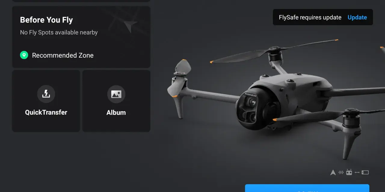
DJI FlySafe is best understood as a safety-and-awareness layer rather than a magic pass to fly anywhere. It warns you about sensitive airspace, labels geofenced areas, and adds friction where DJI thinks a flight needs a second look, but it does not replace local aviation rules or your own judgment. For drone pilots in the UK, that distinction matters: the app can help you avoid obvious mistakes, yet the final decision still has to be legal, safe, and backed by the current airspace picture.
The key things to know before you trust the app
- FlySafe is advisory, not an official source of UK airspace law.
- DJI zones are designed to warn, limit, or block flights depending on the location and risk level.
- In the UK, you still have to obey the CAA rules on restricted airspace, 120 m/400 ft, and visual line of sight.
- Obstacle sensing, Return-to-Home, and signal-loss actions help, but they do not make a bad plan safe.
- DJI says its old GEO Unlock Request service is being retired, which makes awareness more important than ever.
- The best workflow is to check DJI and official UK sources together before takeoff.
How the GEO map works in practice
When I look at DJI’s geofencing system, I think in terms of friction, not freedom. The map is there to reduce accidental flights into sensitive airspace, and it does that by turning some areas into warnings while turning others into hard stops. That is useful because the most expensive drone mistakes are often the most ordinary ones: a takeoff near an airport, a launch too close to a prison or government site, or a flight that climbs higher than the pilot intended.
The system uses GEO zones to mark areas with different levels of restriction. Some zones only warn you, some ask for confirmation, and some block takeoff entirely. DJI also says the data is advisory only, which means the app is a layer of safety awareness, not an official aeronautical source. That matters because the app can be slightly conservative, slightly outdated, or simply not aligned with the most recent local notice.
| Zone type | Typical app behaviour | What I would take from it |
|---|---|---|
| Warning zones | Warning only, and they may not always be obvious on the map | Check the official airspace picture before you launch |
| Enhanced warning zones | Warning plus a confirmation step at flight time | Treat this as a strong signal to investigate before continuing |
| Authorization zones | Flight is limited by default and may require a current unlock or authorization flow | Do not assume you can fly just because the site looks open |
| Restricted zones | Red areas where flight is prevented | Plan elsewhere unless you have explicit lawful authorization |
| Altitude zones | Gray areas where height may be limited | Watch vertical separation as carefully as the location itself |
Two details matter more than most pilots realise. First, the GEO layer is a 2D representation of a 3D environment, so altitude still changes the risk. Second, DJI’s own guidance says the boundaries can differ from official charts, which is why I never use the map as my only reference. That leads straight into the UK side of the story.
Why the UK rules still come first
In the UK, the Civil Aviation Authority still sets the baseline. That means you need to respect restricted airspace, stay below 120 m/400 ft in the open category, and keep the drone in direct sight at all times. If your aircraft weight and camera configuration trigger registration requirements, you also need the right Flyer ID and Operator ID. And if you are taking off or landing on private land, you still need the landowner’s permission.
- 120 m / 400 ft is the ceiling for standard open-category flying.
- Visual line of sight is not optional unless you have the right authorisation for something more advanced.
- Restricted airspace remains off-limits even if a map looks empty.
- Flyer ID and Operator ID apply when the aircraft weight and camera combination requires them.
- Takeoff and landing permission still belongs to the landowner or occupier, not the app.
- Night flights in the open category require a green flashing light.
The practical rule is simple: if DJI and the UK rules point in different directions, the more restrictive interpretation wins. A blue or red zone on the map is a prompt to investigate, not a substitute for compliance. Once that boundary is clear, the rest of DJI’s safety stack starts to look more useful and less magical.
The safety features that do the real work
What I like about DJI’s safety ecosystem is that it is layered. Geofencing handles place-based risk, but the aircraft’s onboard safety features handle the moments when the flight itself starts to drift. That combination matters because many incidents are not caused by the wrong map alone; they happen when the pilot is distracted, overconfident, or dealing with a weak signal in a confined space.
- Obstacle avoidance can be set to brake or bypass on supported models, but it is not a guarantee. In Sport mode, some models disable it automatically.
- Return-to-Home is worth setting before takeoff, especially if the signal drops or the drone starts to drift farther than planned.
- RTH altitude should be higher than the tallest obstacle around you, otherwise the return path can create its own collision risk.
- Signal-loss action should be checked in advance so the aircraft does what you expect if the link breaks.
- Find My Drone is a recovery tool, not a planning tool, but it is still worth knowing where it sits in the app.
These features work best when they are boringly routine. I am much more interested in the operator who knows where the RTH button is than the one who trusts a sensor to rescue a bad launch site. That is why a repeatable preflight routine matters more than any single setting.
My preflight routine for a UK flight
If I were flying in the UK today, I would keep the check as short and disciplined as possible. The goal is not to admire the app; it is to remove surprises before the motors start.
- Check the official UK airspace picture first, including any temporary restrictions or local notices.
- Open the DJI map and confirm whether the launch point sits in a warning, authorization, restricted, or altitude zone.
- Verify that the takeoff and landing spot is actually permitted by the landowner or occupier.
- Set Return-to-Home altitude and signal-loss behaviour before arming the motors.
- Confirm battery reserve, GPS quality, visibility, and wind before lift-off.
- If the app warns me, I stop and investigate instead of trying to work around it.
This is the part many pilots skip: the safest flight plan is the one that still makes sense when the app is wrong, the weather changes, or the site turns out to be busier than it looked from the car park. That matters even more now that DJI is changing how its GEO system handles unlocking.
Why I treat FlySafe as a preflight habit
According to DJI, the old GEO Unlock Request service is being retired in 2026, and that tells you something important about where the system is heading. The value is no longer in chasing a bypass; it is in catching mistakes early and making the operator stop and think. In other words, the tool is becoming more about awareness than permission.
- Use the zone map to catch obvious airspace risks before takeoff.
- Use official UK sources to decide whether the flight is actually allowed.
- Do not confuse “the app lets me” with “the flight is compliant.”
- Assume maps, sensors, and weather can all be wrong in small but important ways.
For UK pilots, that is the cleanest way to work: treat DJI’s safety layer as a warning system, not a waiver, and let the law, the map, and your own judgment agree before the motors start.