The practical case for drones in construction is no longer about novelty; it is about faster site data, safer inspections, and better decisions. In the UK, the conversation now also includes compliance, data handling, and how aerial capture fits into an existing project workflow rather than sitting outside it. This article looks at the uses that matter, where drones save time, where they do not, and what a construction team needs to get right before flying.
What matters most when aerial capture becomes part of a live project
- Drones are most useful when they produce repeatable site data, not just aerial footage.
- The strongest use cases are progress monitoring, earthworks, stockpile measurement, roof and facade inspections, and hazard checks.
- The real value comes from the workflow around the flight: planning, control points, processing, and clear reporting.
- They work best on open, changing, or hazardous sites and are weaker in confined, cluttered, or wind-sensitive environments.
- In the UK, 2026 rules matter: registration, Flyer ID, Remote ID, and the right operational category can affect how a site team flies.
- The smartest rollout starts with one repeatable deliverable and one accountable owner, not with buying the most expensive aircraft.
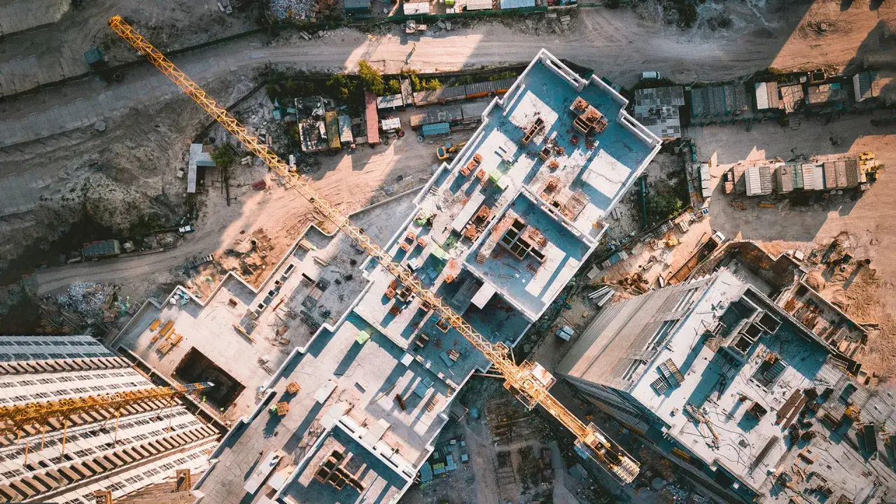
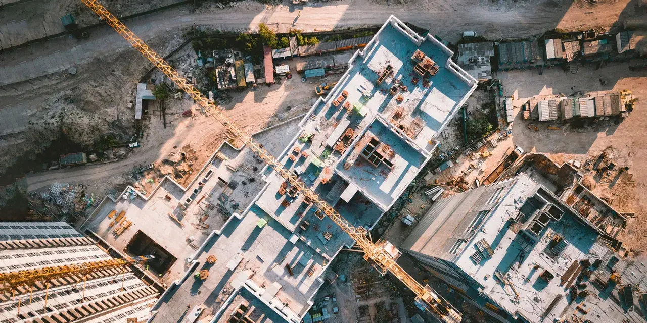
What drones actually do on a building site
I treat a drone as a data-capture tool first and an aircraft second. On a live project, the machine is usually there to collect images, measure volumes, map surfaces, or inspect areas that are awkward, slow, or unsafe to reach on foot.
The outputs matter more than the flight itself. A single sortie can produce an orthomosaic, which is a stitched, map-like image of the site; a point cloud, which is a dense 3D set of measured points; or a model that can be compared with design data. That is why drones are strongest when they are tied to surveying, BIM, and site reporting.
| Construction task | What the drone captures | Why it matters | Best fit |
|---|---|---|---|
| Topographic surveys | High-overlap imagery or LiDAR data | Speeds up pre-start planning and site design | RTK multirotor or fixed-wing on large sites |
| Progress monitoring | Repeatable aerial images and 3D models | Creates objective records for stakeholders | Multirotor with consistent flight plan |
| Earthworks and stockpiles | Surface models and volume measurements | Improves quantity checks and payment claims | RTK drone with photogrammetry workflow |
| Roof and facade inspection | Close-up images, thermal data, or both | Reduces access risk and scaffolding dependency | Small multirotor with suitable payload |
| Safety review | Wide-area overhead views | Helps identify exclusion-zone issues and hazards | Lightweight drone with a disciplined flight plan |
As a rule, the more repetitive the capture needs to be, the more valuable the drone becomes. That is also why the next question is not “Can I fly here?” but “What workflow am I trying to improve?”
Where the workflow creates real value
I have found that the biggest gains come from predictable workflows, not ad hoc flights. If the team knows what it wants before takeoff, the drone becomes part of project control; if not, it just creates more imagery to sort through later.
Progress monitoring
Progress reporting is one of the cleanest use cases because it benefits from repetition. A site can be flown on the same route, at the same height, and from the same angles each week, creating an honest visual record of what changed and when. That helps project managers, clients, and subcontractors see the same facts instead of arguing over different site photos.
Earthworks and volumes
For cut-and-fill work, stockpiles, and terrain changes, aerial data is usually faster than hand-measuring a big site. I like this use case because it turns a tedious task into something measurable and repeatable. The catch is accuracy discipline: you need good planning, correct overlap, and proper ground control or RTK support if the numbers are going to hold up.
Inspections
Roofs, cladding, chimneys, crane components, temporary works, and hard-to-access elevations are all obvious targets. The drone does not replace an expert inspector, but it often removes the need to put that person in a risky position just to get a first look. In practice, that can mean fewer cherry pickers, less scaffolding pressure, and faster decisions on whether a closer inspection is really needed.
Safety and coordination
Overhead imagery is useful for spotting access issues, stacked materials, poor housekeeping, and clashes around exclusion zones. I also see value in pre-lift planning and logistics, especially on crowded urban sites where a single bad layout decision can slow everything down. The drone gives the team a shared visual language, which matters more than people sometimes admit.
Once the workflow is clear, the next question is economic: where does aerial capture genuinely pay off, and where is a ground-based method still the better call?
When drones save time and when they do not
The honest answer is that drones are not the best tool for every site. I would use them when the site is large, changing quickly, dangerous to access, or difficult to measure by hand. I would be much more cautious when the environment is tight, windy, cluttered, or heavily obstructed.
| Situation | Drone is strong | Drone is weaker |
|---|---|---|
| Large outdoor earthworks | Fast coverage, good visualisation, useful volumes | Needs good control for reliable measurements |
| Urban infill sites | Useful for periodic documentation | Space, obstacles, and airspace can complicate operations |
| Indoor or enclosed areas | Specialist drones can help in some cases | Regular multirotors are often the wrong tool |
| Dense vegetation or occluded structures | LiDAR can improve capture | Photogrammetry alone may miss hidden surfaces |
| Routine progress documentation | Excellent when repeated on a schedule | Poor if no one uses the outputs |
There is one point I keep repeating to project teams: a drone is not a replacement for survey control, a qualified inspection, or a proper QA process. It extends those disciplines. If the underlying standard is weak, the aerial output will not rescue it.
How to choose the right drone setup
I would not start with the aircraft. I would start with the deliverable. If the goal is weekly site progress imagery, the priorities are consistency, easy operation, and clean software integration. If the goal is accurate topography or volume calculations, positional accuracy matters more than camera gimmicks. If the site is partially obscured, LiDAR starts to become more interesting.
| Setup | Best for | Strengths | Trade-off |
|---|---|---|---|
| RGB multirotor | Progress shots, roofs, simple inspections | Easy to deploy, flexible, widely used | Limited in heavy occlusion and advanced measurement |
| RTK multirotor | Surveying, volume checks, repeatable mapping | Better positional accuracy and cleaner outputs | Higher cost and more setup discipline |
| Fixed-wing drone | Very large sites and long linear corridors | Longer coverage per flight | Less convenient in confined construction environments |
| LiDAR-equipped platform | Vegetation, complex geometry, partial occlusion | Sees through gaps better than RGB alone | Expensive and harder to justify for simple projects |
| Thermal payload | Envelope issues, moisture suspicion, electrical checks | Finds problems not visible in RGB | Interpretation skill is essential |
The expensive mistake is buying capability you will not use. For many contractors, a well-run RGB and RTK workflow is enough for 80 percent of the value. If you need better data than that, then LiDAR or specialist payloads start to make sense.
What UK rules mean for construction teams in 2026
In the UK, compliance is no longer a side note. The CAA’s 2026 rule updates mean teams need to pay attention to registration, Flyer ID requirements for drones over 100g, Remote ID expectations, and the class-marking framework that affects what can be flown in the open category.
- Operator responsibility matters because work flights should be tied to a named, accountable operator.
- Flyer competence matters because site staff need to know the rules before they put a drone in the air.
- Hardware choice matters because not every drone will fit every category or site profile.
- Location matters because urban sites, congested areas, and jobs near people often need extra care or authorisation.
- Future BVLOS capability matters because the CAA is moving toward routine beyond-visual-line-of-sight operations by 2027, which will be relevant for long corridors and larger infrastructure work.
My practical advice is simple: do not let the pilot be the only person who understands the rules. If the site team, safety lead, and project manager all know the basic constraints, the operation is much smoother and far less risky. Regulation is one part of the job; repeatable execution is the other.
How I would run a drone programme on a live site
The best programmes I have seen are boring in the right way. They use the same capture standards, the same file naming, the same review process, and the same decision path every time. That consistency is what turns a flight into a control tool.
- Pick one primary use case, such as weekly progress reporting or earthworks volumes.
- Define the output before the first flight so everyone knows what “done” looks like.
- Set a capture routine with fixed routes, fixed altitudes, and clear weather limits.
- Use quality control with ground checks, control points, or RTK validation where accuracy matters.
- Integrate the results into existing project tools instead of leaving them in a separate folder.
- Protect the data because site imagery can reveal security-sensitive details, logistics, and programme status.
That last point is often overlooked. On a modern site, drone imagery is not just visual content; it is operational information. I would treat it with the same care as programme documents, drawings, or commercial reporting, especially on sensitive projects.
The first 30 days of a useful drone programme
If I were rolling this out on a UK project, I would start small and measurable. The goal is not to prove that drones are exciting; it is to prove that they improve one real workflow without adding avoidable friction.
- Week 1: choose one use case and one project sponsor.
- Week 1: confirm the airspace, permissions, and site restrictions.
- Week 2: define the capture plan, the deliverable format, and the review cadence.
- Week 2: run a test flight and check whether the output is actually usable.
- Week 3: compare the drone output with your existing survey or reporting method.
- Week 4: decide whether to keep it in-house, outsource it, or upgrade the workflow.
The pattern is straightforward: start with a narrow business problem, build a repeatable process around it, and only then expand to other uses. That is the difference between a drone that sits on a shelf and one that genuinely improves how a project is run.